


LES ROUGES FEIGNES

surceneux
User
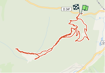

Length
7.5 km

Max alt
1163 m

Uphill gradient
214 m
Km-Effort
10.4 km

Min alt
994 m

Downhill gradient
213 m
Boucle
Yes
Creation date :
2021-05-20 12:30:35.36
Updated on :
2021-05-20 15:26:08.394
2h36
Difficulty : Easy

FREE GPS app for hiking
 SityTrail
IGN / Geographical institutes
SityTrail Plus
The world is yours!
About
Trail Walking of 7.5 km to be discovered at Grand Est, Vosges, La Bresse. This trail is proposed by surceneux.
Description
CHEMIN MOREL CHEMIN DIELAINE ANNEAU ROUGE
Positioning
Country:
France
Region :
Grand Est
Department/Province :
Vosges
Municipality :
La Bresse
Location:
Unknown
Start:(Dec)
Start:(UTM)
348568 ; 5323535 (32U) N.
Comments